Auto Count for automatic object counting
Auto Count detects and counts objects across a processed drone survey. Choose one object type, or let MapperTool select a suitable category automatically. The detected objects appear on the RGB orthomosaic as points or polygons that you can review and correct.
The module is useful when a manual count would take too long, such as counting cars, trees, individual plants, bales, solar panels, buildings or material stockpiles across a large site.
Auto Count provides an automated estimate. Image resolution, shadows, occlusion, dense vegetation and objects that touch each other can affect the result. Review the detected objects before using the count as a final inventory.
Requirements
Auto Count is available on the Plus and Pro plans. The project must be finished and contain both:
- An RGB orthomosaic for detecting visible objects.
- A Digital Surface Model (DSM) for checking their height and surface context.
Use High processing quality when possible. The additional detail is especially helpful for small objects and dense groups. Medium quality can still work when the target remains clearly visible at that resolution.
If you save a crop in the viewer before starting Auto Count, the module searches only inside that area. Without a saved crop, it analyses the shared valid coverage of the complete orthomosaic and DSM.
Choose what to count
Open the finished project in the viewer, select Modules, find Auto Count, and choose Start counting. You can select:
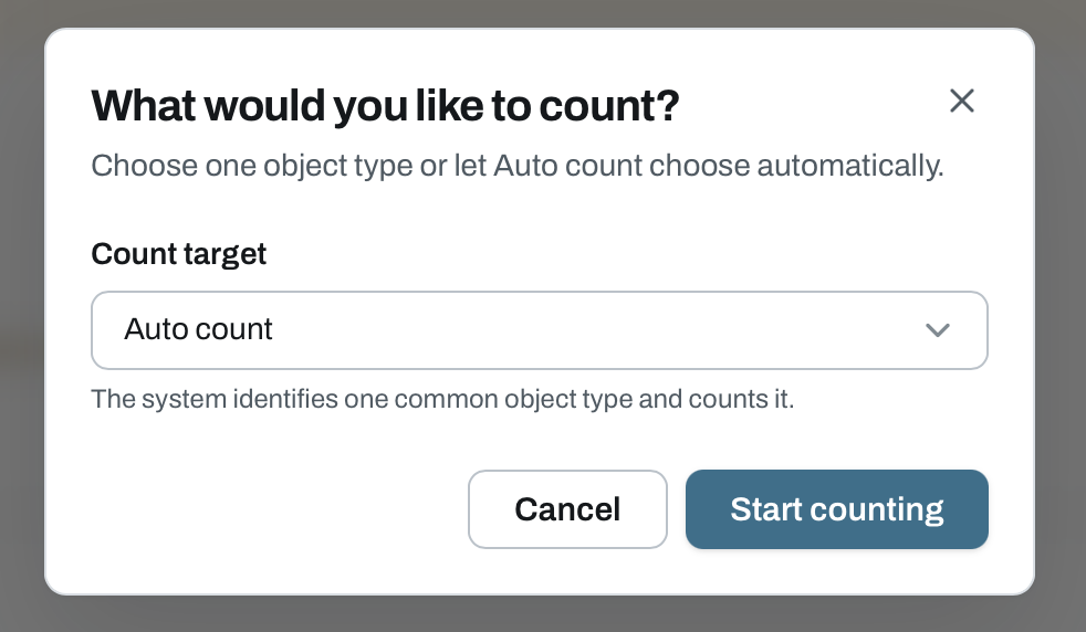
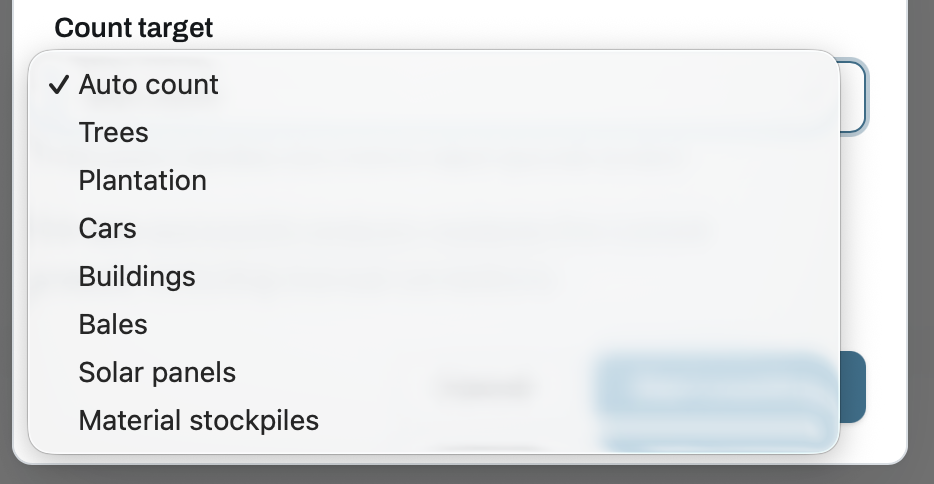
- Auto Count, which chooses one supported object type automatically.
- Trees, including individual trees in forests and orchards.
- Plantation, for visible individual crops such as sunflowers, maize and seedlings.
- Cars.
- Buildings.
- Bales, including visible hay, straw and wrapped bales.
- Solar panels. This counts visible panels, and you can use Solar Inspect for thermal anomaly detection.
- Material stockpiles. This counts separate piles but does not calculate their volume. Use the volume tool for measurements.
Selecting a category tells the module to search only for that type. Automatic mode selects a single category, and it does not combine unrelated objects into one count.
Run the analysis
Auto Count runs separately from the original photogrammetry job. Processing usually takes 5–10 minutes, depending on the project size, resolution and selected object type. Progress is shown on the module card.
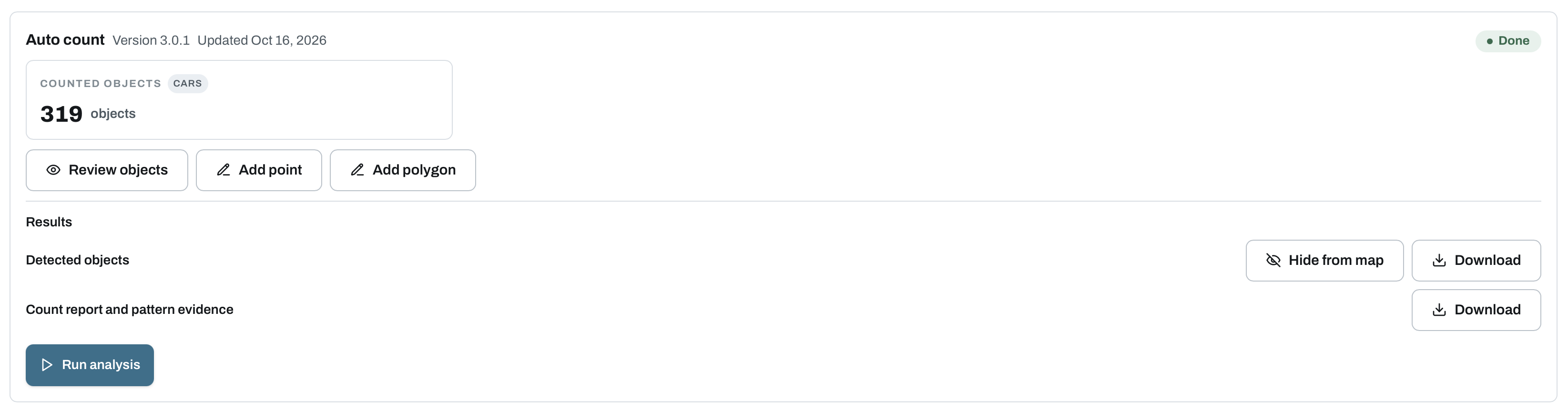
When the run finishes, the card shows the detected category and total count. You can review the objects, add a point or polygon, show or hide the overlay, and download the detected objects or the count report.
Results on the map
The detected objects appear automatically on the RGB orthomosaic. Depending on the category and available geometry, a result can be represented by a point or an outline polygon.
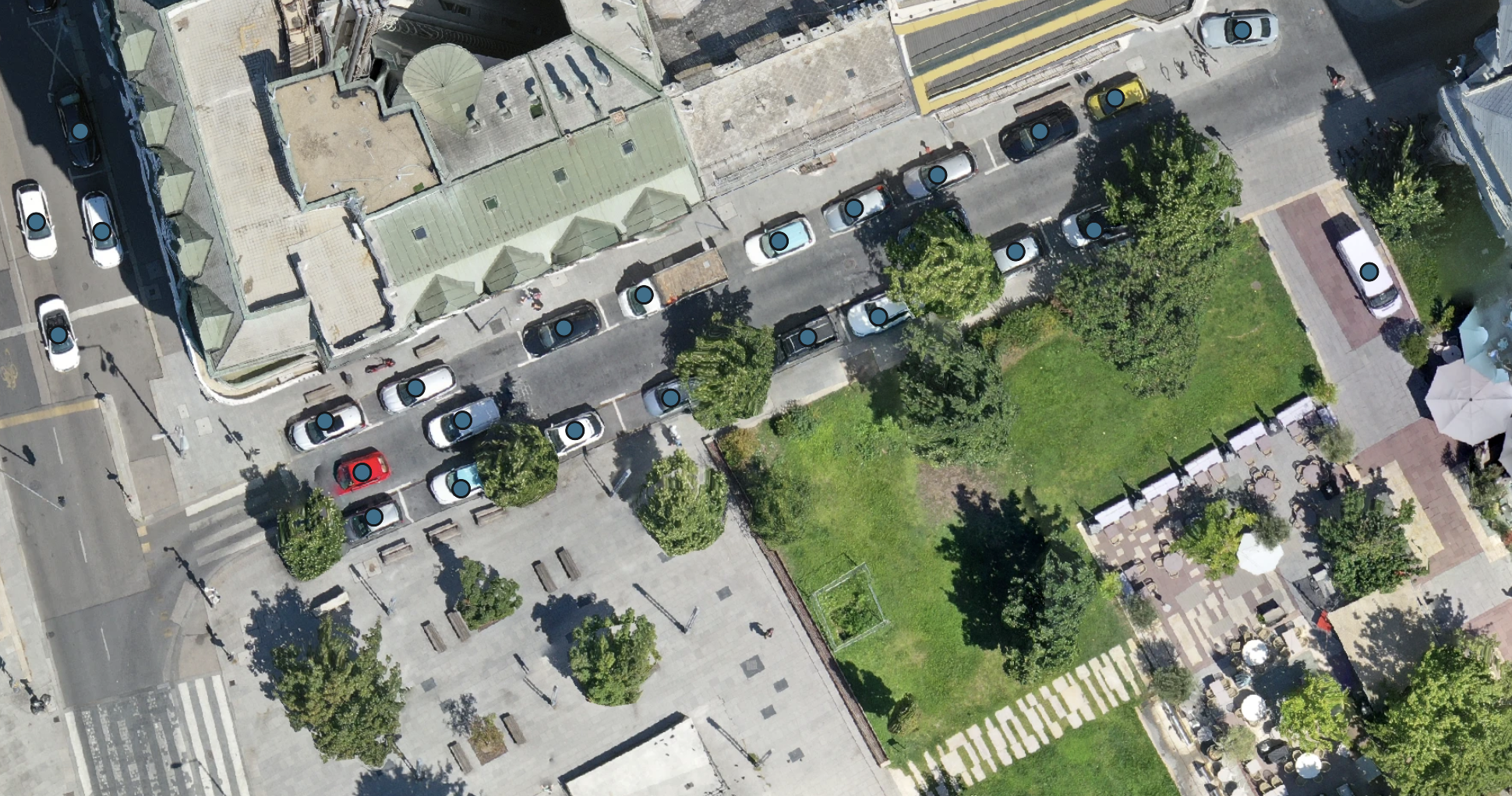
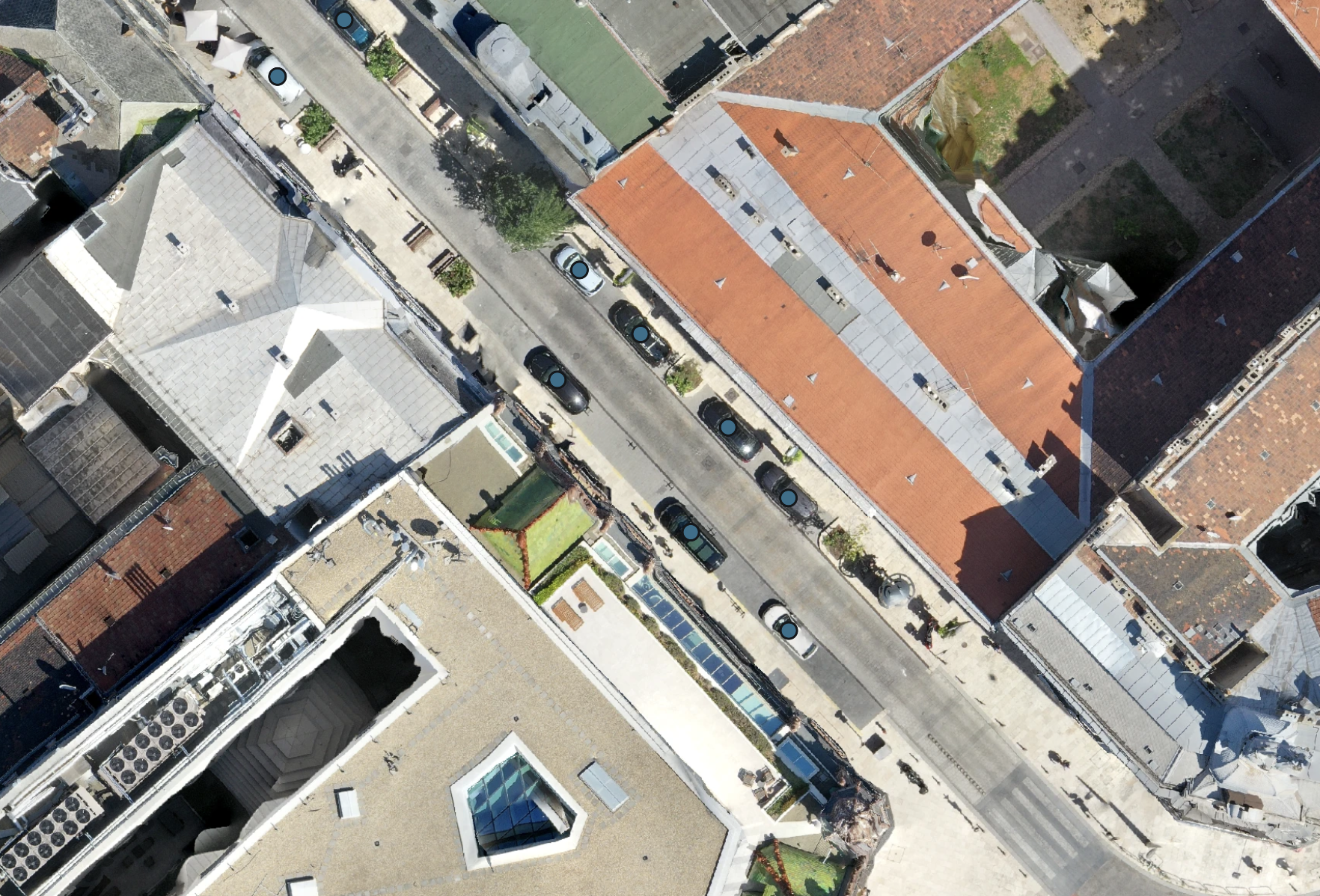
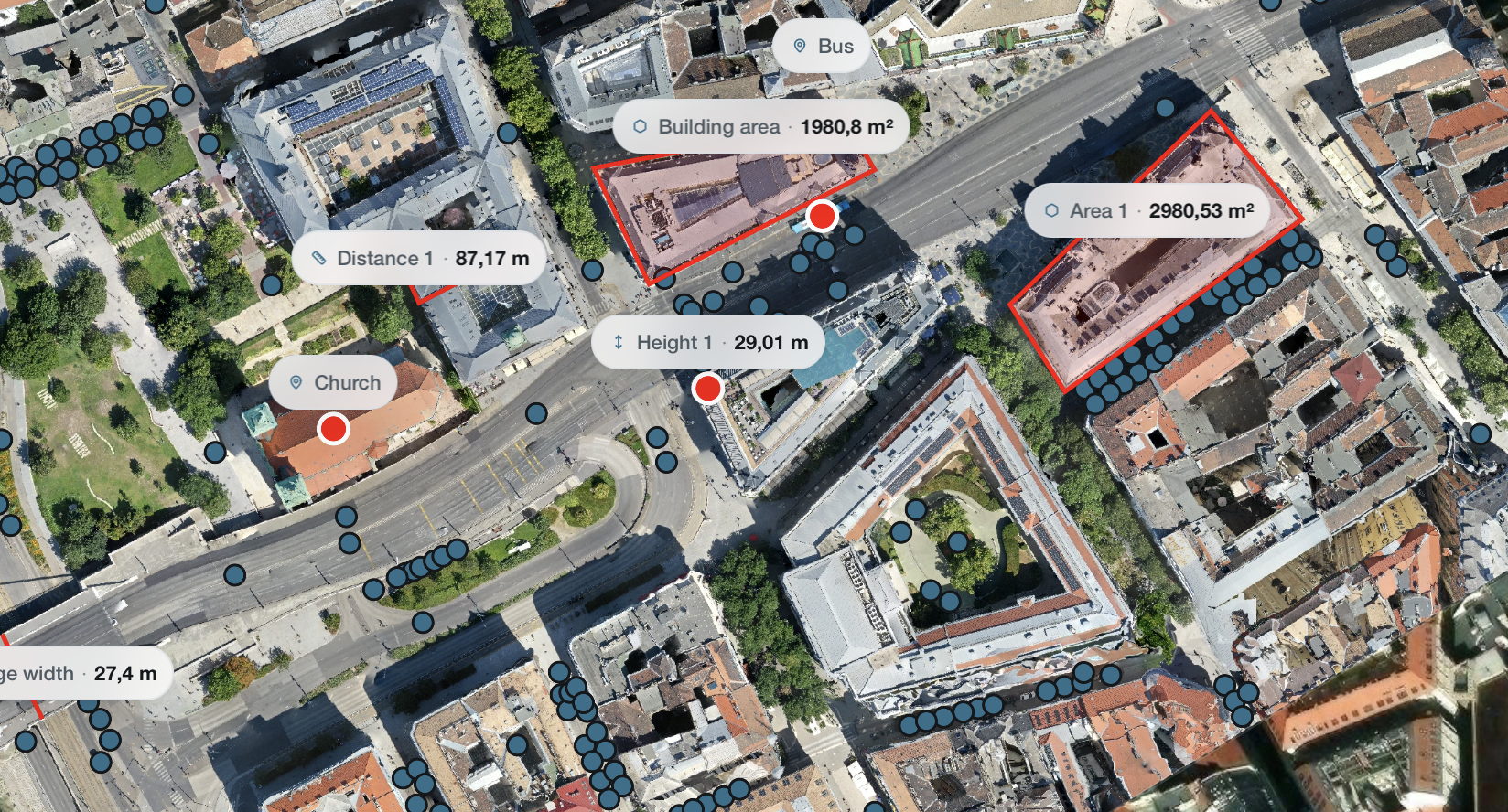
Auto Count results remain visible alongside the normal viewer tools and saved measurements. Use Hide from map when you want to inspect the source image without the overlay.
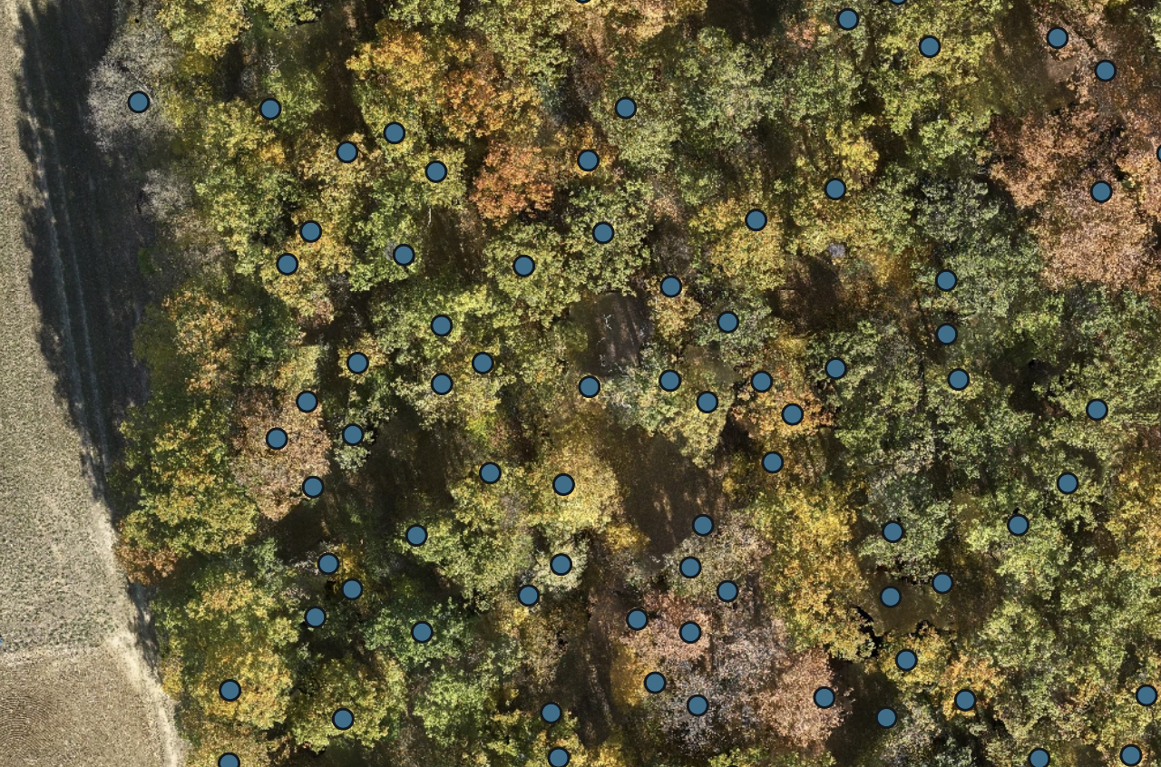
Review and correct detected objects
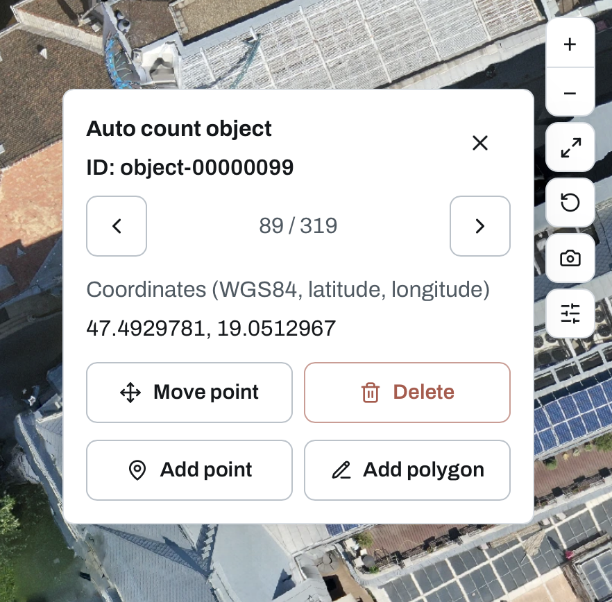
Select any point or polygon to open its object record. The panel shows its ID, coordinates and position in the result list. Use the previous and next controls to review objects one by one.
You can:
- Move a point to its correct position.
- Redraw a polygon around the object.
- Delete a false detection.
- Add a point for a missed object.
- Add a polygon when an outline represents the object better.
Manual corrections are saved with the project and update the displayed count. They are also included in the downloaded detected-object file. View-only users can inspect the result, while project owners and editors can correct it.
A successful new analysis replaces the previous result and its manual edits. If the new run fails, the last published result and saved corrections remain available.
Download the results
The module provides two downloads:
- Detected objects, a GeoJSON file containing the reviewed points and polygons.
- Count report and pattern evidence, containing the run summary and the information behind the selected category and count.
The detected-object file can also be exported in another coordinate system through the viewer's coordinate system selector.