Digital Surface Model (DSM)
A DSM, Digital Surface Model, records the height of everything the camera saw. Ground, buildings, trees, vehicles, stockpiles. It is the top surface of the scene.
It is one of the two digital elevation models MapperTool produces. A digital elevation model is any raster that stores a height value per pixel, and the difference between the two is what they include. The DSM keeps everything standing on the site, while the DTM strips it back to bare ground.
Download format: GeoTIFF, with elevation values stored per pixel.
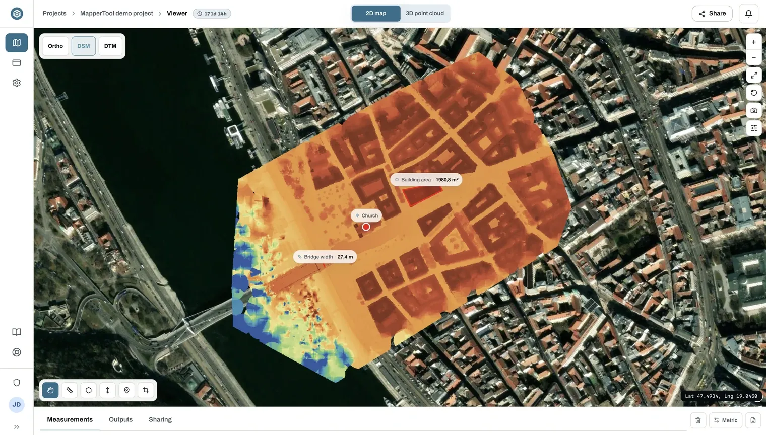
In the viewer the model is drawn with a colour ramp and a legend showing the elevation range in metres.
What it is used for
- Object heights. Buildings, stockpiles, equipment and vegetation.
- Volume. The DSM is what the volume tool measures against. Outline an area in the viewer and you get the volume above ground inside it, in cubic metres.
- Line of sight and shading studies, where the objects on the ground matter.
- Roof and structure surveys, where the built form is the subject.
DSM or DTM
- Interested in what stands on the site? Use the DSM.
- Interested in the ground itself? Use the DTM.
- Subtracting the DTM from the DSM gives the height of everything standing on the ground across the whole site.
DSM and DTM are separate outputs. Select both if you want to compare them.
Both open as layers in the viewer, where you can take height measurements. Elevation accuracy depends heavily on consistent altitude and good overlap. See flight basics.