Processing quality and GSD
Alongside the outputs, you choose a quality level. It controls the resolution of the result and how long the job takes.
What GSD means
GSD, ground sample distance, is how much real-world ground one pixel of the finished map covers.
- A GSD of 5 cm per pixel means each pixel represents a 5 by 5 cm square on the ground.
- A smaller number means finer detail.
- GSD depends on flight altitude and camera resolution. Fly lower, get a smaller GSD.
The three levels
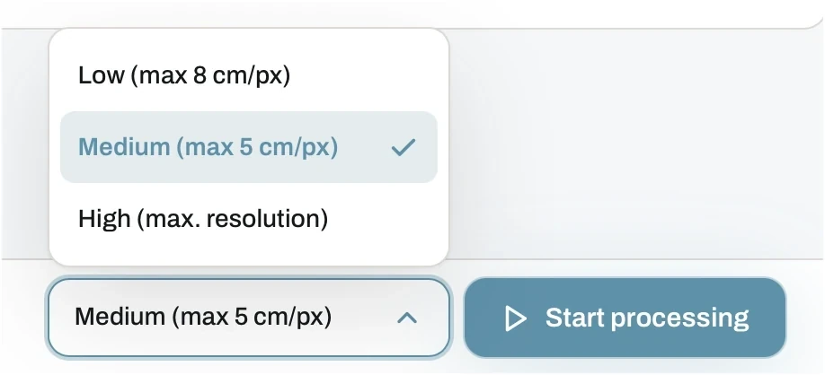
The level sits next to the Start processing button, so it is the last thing you set before the job runs.
The levels work as upper limits, not as fixed values. The whole project is processed at the chosen level, but never coarser than the cap.
- Low (max 8 cm/px). The fastest option, good for a quick overview or a large site where the general picture is enough.
- Medium (max 5 cm/px). The default, and the balanced choice for site documentation, measurement and most client work.
- High (max. resolution). No cap. The system processes at the best resolution your images actually contain.
Good to know
High resolution processing is available on the Plus and Pro plans. Low and medium work on every plan. See pricing.
Picking a level
- Resolution cannot exceed what the flight captured. The quality check estimates the GSD of your set before you process, so you know the ceiling in advance.
- Need fine output? Fly lower with generous overlap. See flight basics.
- High takes noticeably longer and produces much larger files.
- A project can only be reprocessed once, so pick deliberately rather than by trial and error.