Orthomosaic map
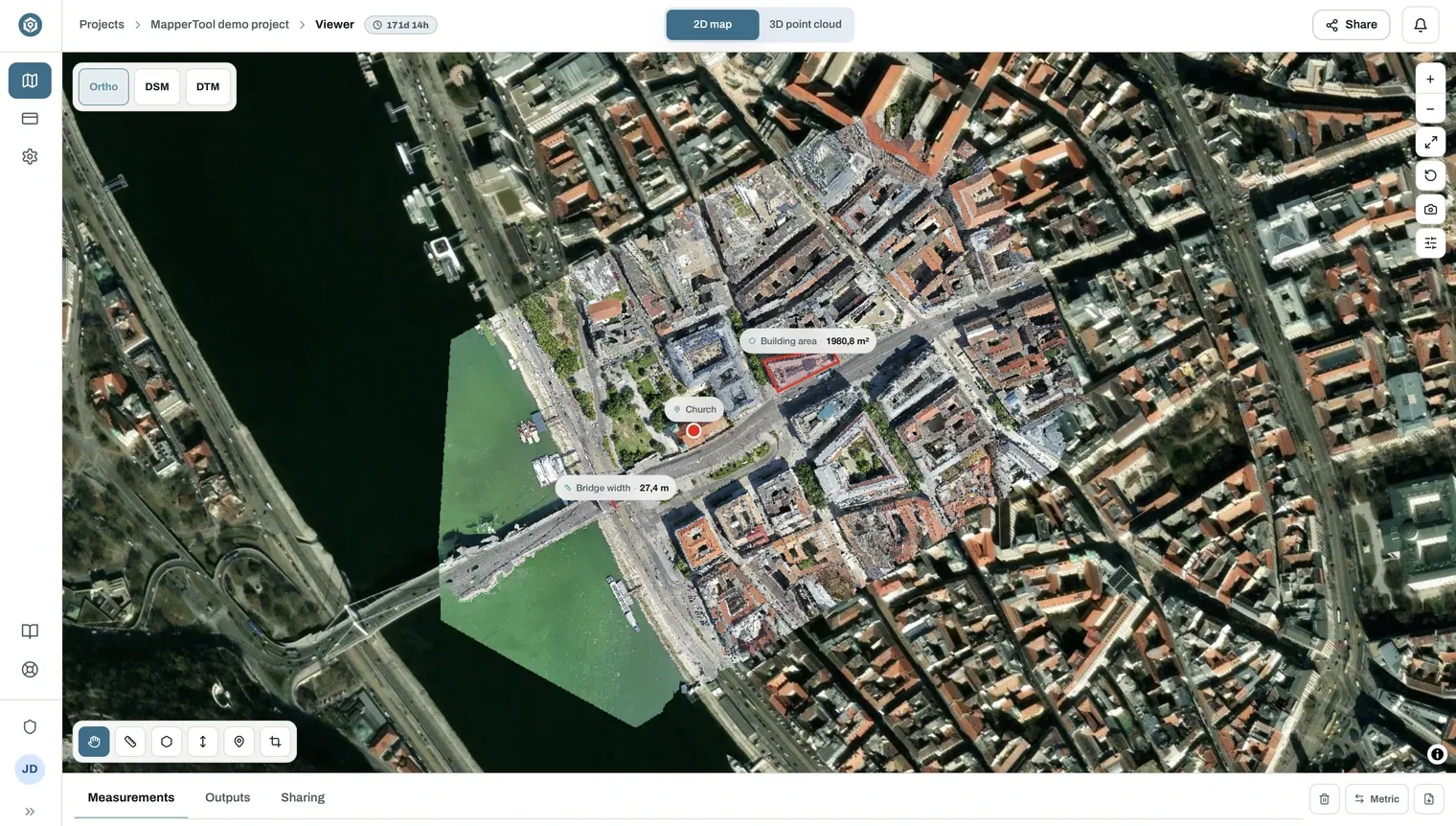
An orthomosaic map is a single seamless aerial image, stitched from all your drone photos and geometrically corrected so every pixel sits in its true map position. You will also see the term written as two words, ortho mosaic, and some software calls the result an orthophoto. They all mean the same thing.
A raw aerial photo is distorted by perspective and terrain, so distances on it are unreliable. An orthomosaic has a uniform scale, which means you can measure on it like on a map.
Download format: GeoTIFF. The georeferencing is stored inside the file,
so it lands in the right place automatically.
What it is used for
- Construction. Site plans, progress documentation across repeat flights, and a base layer for reporting.
- Surveying. A current, measurable base map of a parcel or corridor.
- Agriculture. Field boundaries, drainage patterns and damage assessment.
- Property. Plot and site overviews for listings and planning applications.
Getting a clean result
Sharp, well-overlapped nadir imagery produces the cleanest mosaic. Thin overlap, motion blur and uneven altitude show up as blurring or warping. See flight basics.
You can measure directly on it in the browser with the measurement tools.