Quality check
As soon as you select the images, MapperTool reads their EXIF and reports on the dataset. The check runs before the upload, so you find out whether the set is usable without transferring anything first.
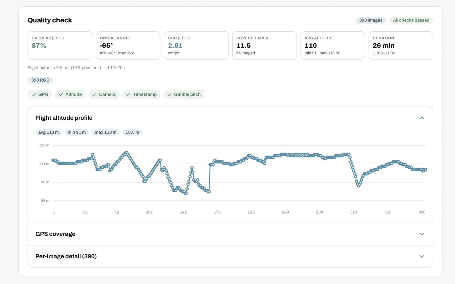
The five checks
Each one is shown as a chip, and the header tells you whether all checks passed.
- GPS. Does every image carry a position? Missing geotags stop processing.
- Altitude. Was the flying height consistent? Large swings mean uneven resolution across the site.
- Camera. Do all images come from the same camera and lens setup? Mixed setups make calibration less reliable.
- Timestamp. Are the capture times continuous and in order? Gaps usually mean a mixed or incomplete set.
- Gimbal pitch. Was the camera angle consistent? This is what tells nadir flights apart from oblique ones.
What the report measures
Alongside the pass or fail chips you get the numbers that describe the flight:
- Overlap (est.) as a percentage.
- Gimbal angle, with the minimum and maximum.
- GSD (est.) in cm per pixel, the resolution your images can support.
- Covered area in hectares, plus the flight extent from the GPS point hull.
- Average altitude, with the minimum and maximum.
- Duration, from the first to the last capture time.
- Image count and sensor, for example 390 RGB. This is what decides whether NDVI and thermal can be selected.
The estimated GSD is the ceiling for your result. Picking the high quality level cannot go finer than what the flight actually captured.
Flight altitude profile
A chart of the flying height across the whole flight, with the average, minimum, maximum and the spread. A flat line means even ground resolution. Deep dips and spikes show where the aircraft climbed or descended, and those areas will differ in detail from the rest.
GPS coverage
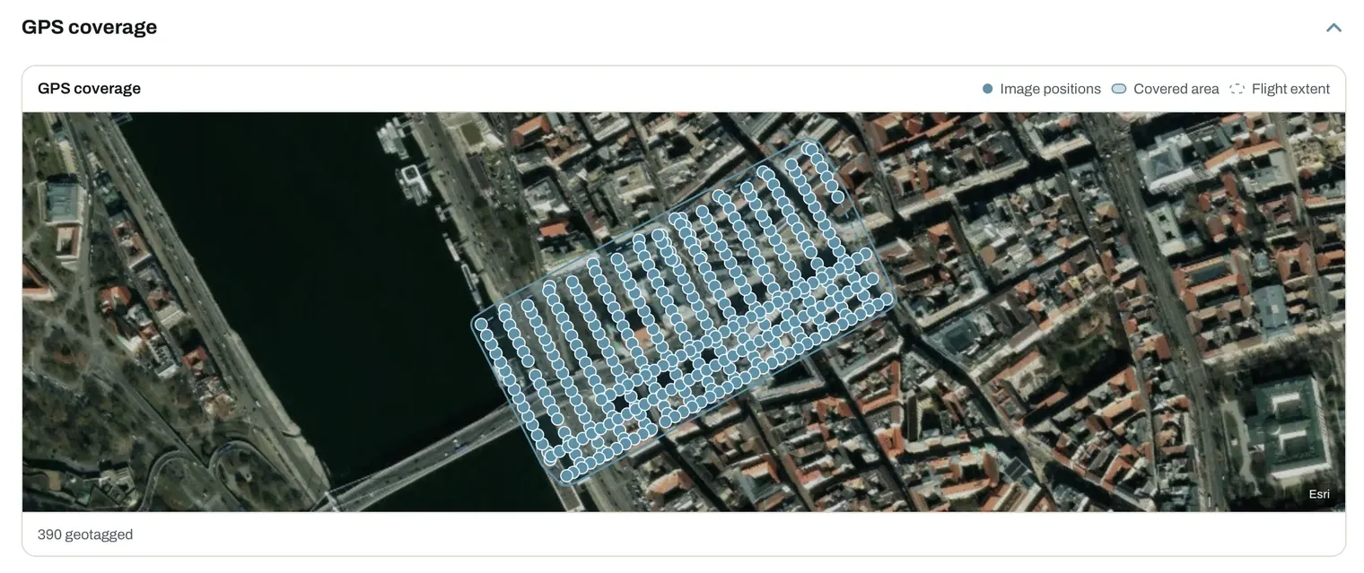
A map of every image position over a satellite basemap, with the covered area and the flight extent drawn on top. Use it to spot gaps in the grid, stray photos from another site, and edges that were only flown once.
Per-image detail
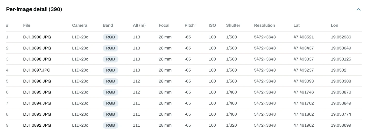
Every file listed with its camera, band, altitude, focal length, gimbal pitch, ISO, shutter speed, resolution and coordinates. This is where you find the one photo that is out of place.
What to do about a warning
- A stray file. A photo from another site, or one taken on the ground. Remove it and select the set again.
- Missing GPS. Use the originals from the camera instead of re-exported copies.
- Thin overlap or uneven altitude. These come from the flight. Fly the area again with the settings in flight basics.
A warning does not block the upload, apart from missing GPS data. It tells you what the result is likely to look like, so you can decide whether to fix the dataset first.
Mixed sensor uploads
A multispectral or thermal flight usually produces ordinary RGB images alongside the special ones. Upload the whole set into a single project. The check identifies each sensor, and processing generates a separate layer per sensor, so you get the orthomosaic and the NDVI or thermal map from one job.
When the report is clean, start the upload.