Managing projects
A project holds one dataset, its processing history and all the results it produced.
The actions menu
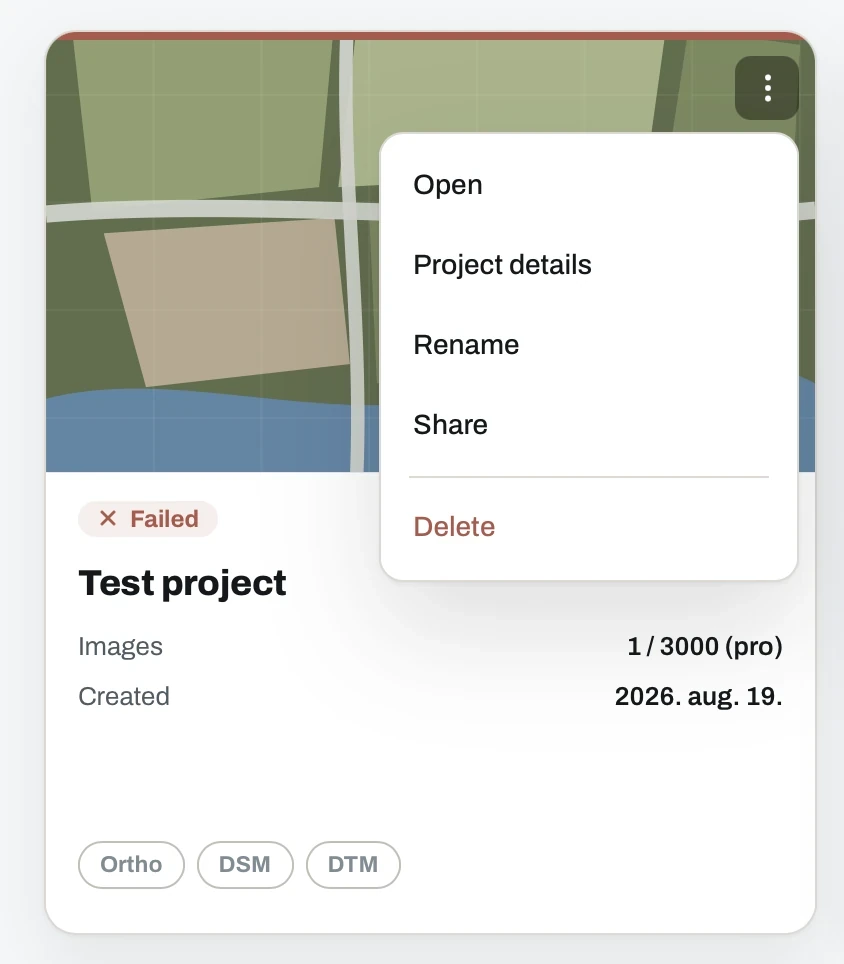
Every project card carries the same menu:
- Open the results in the online GIS viewer.
- Project details for the processing record.
- Rename the project.
- Share with a link or an email invite. See share.
- Delete, which moves it to the Trash.
Project details
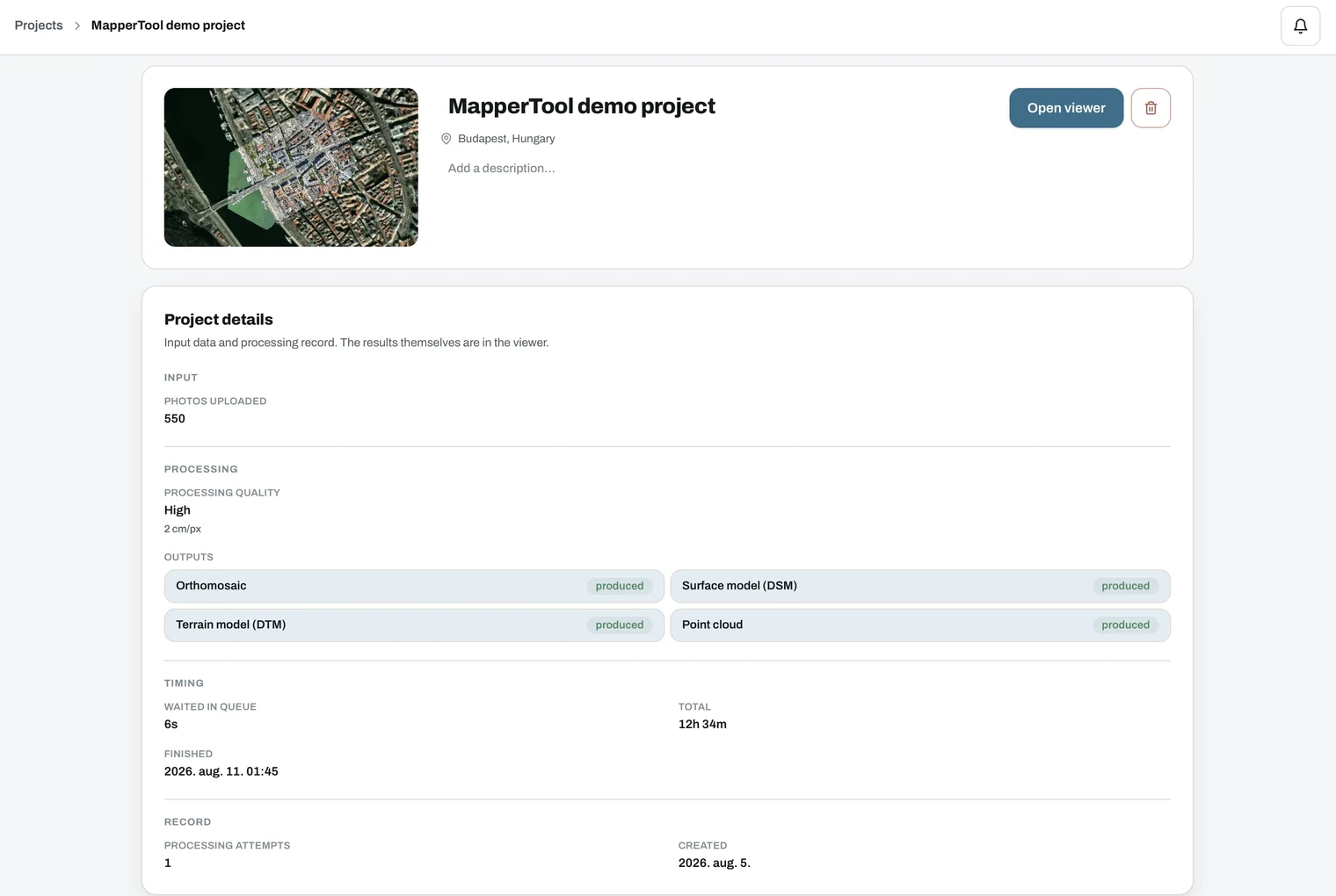
The details page is the full record of what was processed and how.
- Header. Thumbnail, project name, detected location and a free-text description you can add. Open viewer and delete sit on the right.
- Input. How many photos were uploaded, and when the source images carry
GPS data, a GPS accuracy line (for example
±3 cm horizontal, ±5 cm vertical). When the photos were captured with an RTK-enabled drone, an RTK badge appears next to the drone name; a partial badge (RTK 148/150) means only some of the photos got an RTK-fixed position. Flights without an RTK receiver show no badge at all. - Processing. The quality level used and the resulting GSD in cm per pixel.
- Outputs. Each requested output with its state, for example produced.
- Timing. Time waited in the queue, total processing time, and when the job finished.
- Record. Number of processing attempts and the creation date.
Reprocessing is available once per project, with different outputs or a different quality level, and only while the raw images are still stored. See processing.
Generating a PDF report
A report turns a finished project into one document you can send on. No screenshots, no assembling slides by hand.
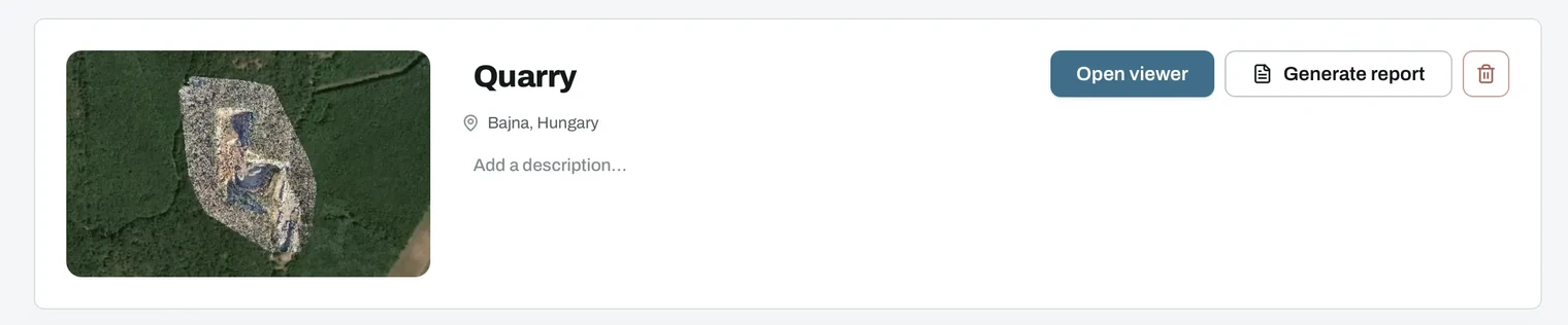
Generate report sits next to Open viewer at the top of the project, and appears once at least one output is ready.
The dialog asks what to include. Everything is on by default, so an unedited report is a full one.
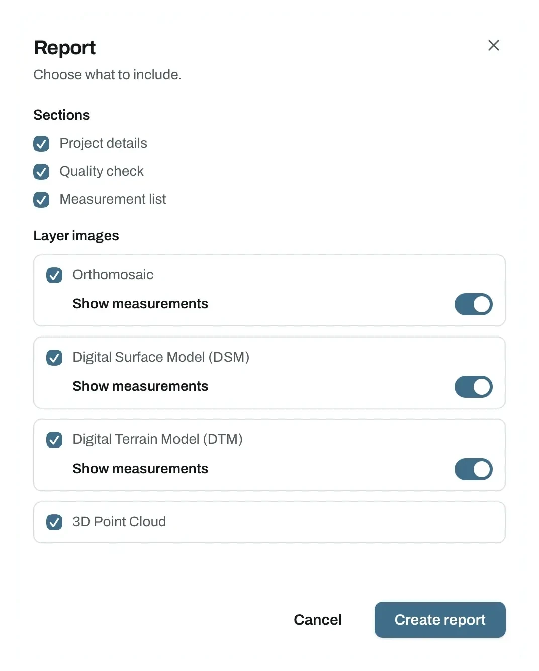
Sections are the written parts. Project details, the quality check summary and the measurement list.
Layer images is one rendered image per finished output, the orthomosaic, DSM, DTM, 3D point cloud and, where they exist, NDVI and thermal.
Each 2D layer carries its own Show measurements switch, so you can put the measured drawing on the orthomosaic and leave the elevation models clean.
Creating the report takes a moment, because every selected layer image is rendered on the spot rather than pulled from a cache. The result opens as a printable preview, and Save as PDF in the print dialog keeps a copy.
The report follows the same plan rule as downloading. Where downloads are locked, the report is locked with them. See pricing.
Deleting a project
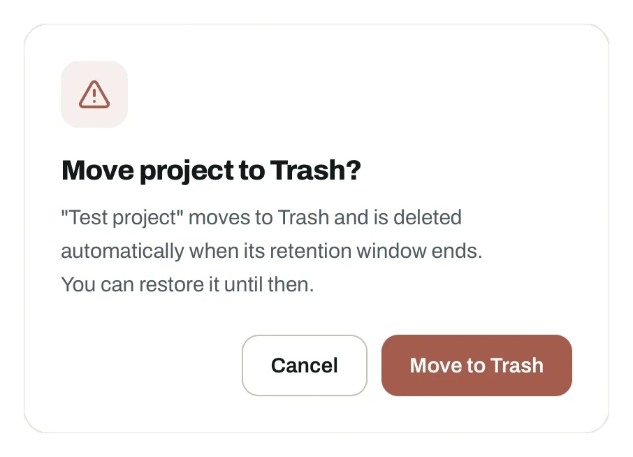
Deleting does not remove a project immediately. It moves to the Trash, which you reach from the filter dropdown on the dashboard.
The dialog tells you what happens next, so a mis-click costs you nothing.
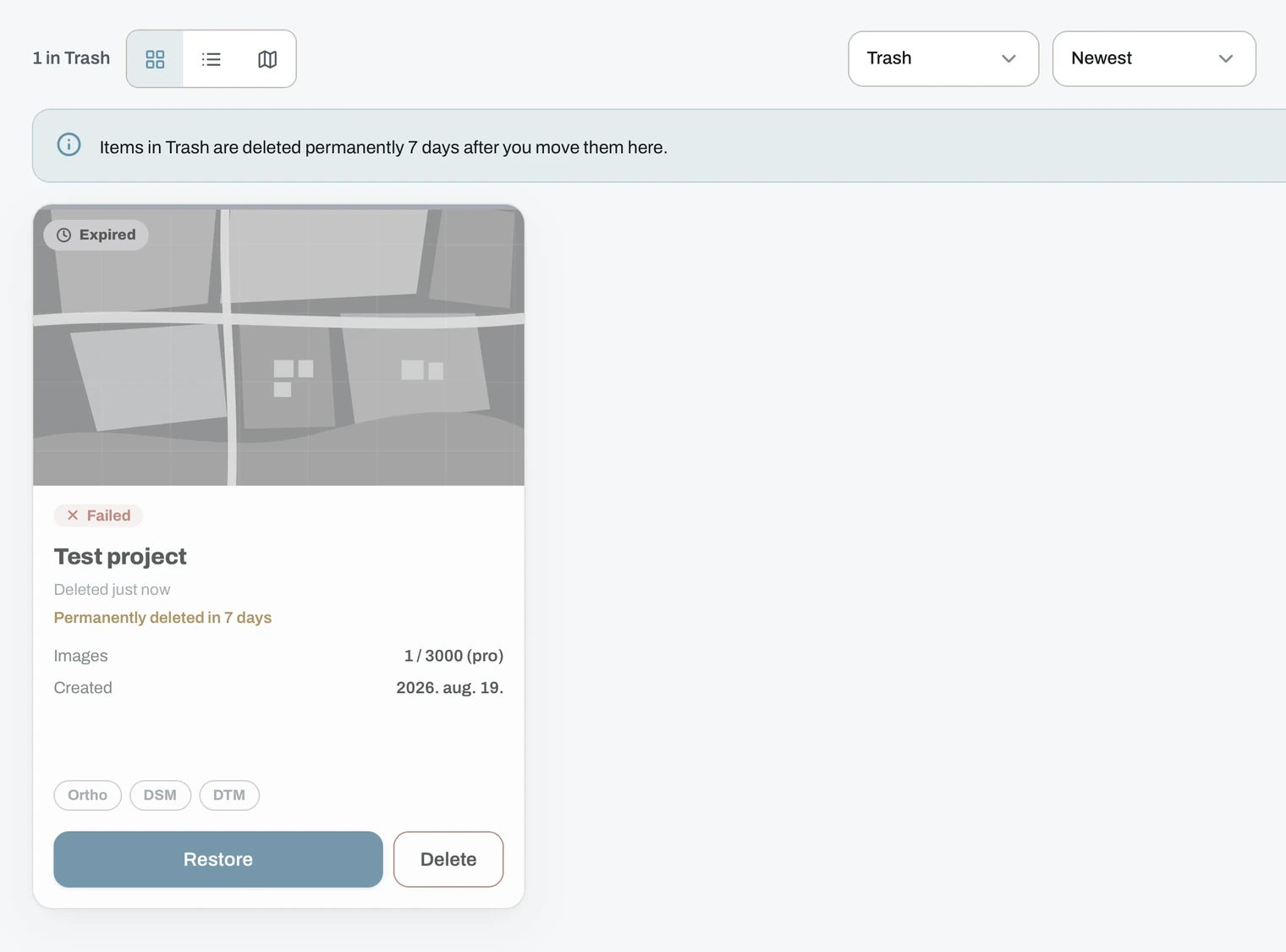
- A project stays in the Trash for 7 days, and each card shows how long is left.
- Restore brings it back to your project list.
- Delete removes it immediately and permanently.
- If the project's own expiry falls inside those 7 days, it is removed at that point instead.
Once a project leaves the Trash, it cannot be recovered. Download anything you need first.
Two clocks are running
Each project has two separate deadlines.
- Raw images. Deleted 24 hours to 7 days after processing, depending on your plan. This is also your reprocessing window. See processing.
- The project and its results. Stored longer, with the countdown visible on the project card. Length depends on your plan. See pricing.
Projects started before registering
A dataset uploaded from the home page without an account moves into your dashboard when you register in the same browser session, ready to process. See starting without an account.