3D point cloud
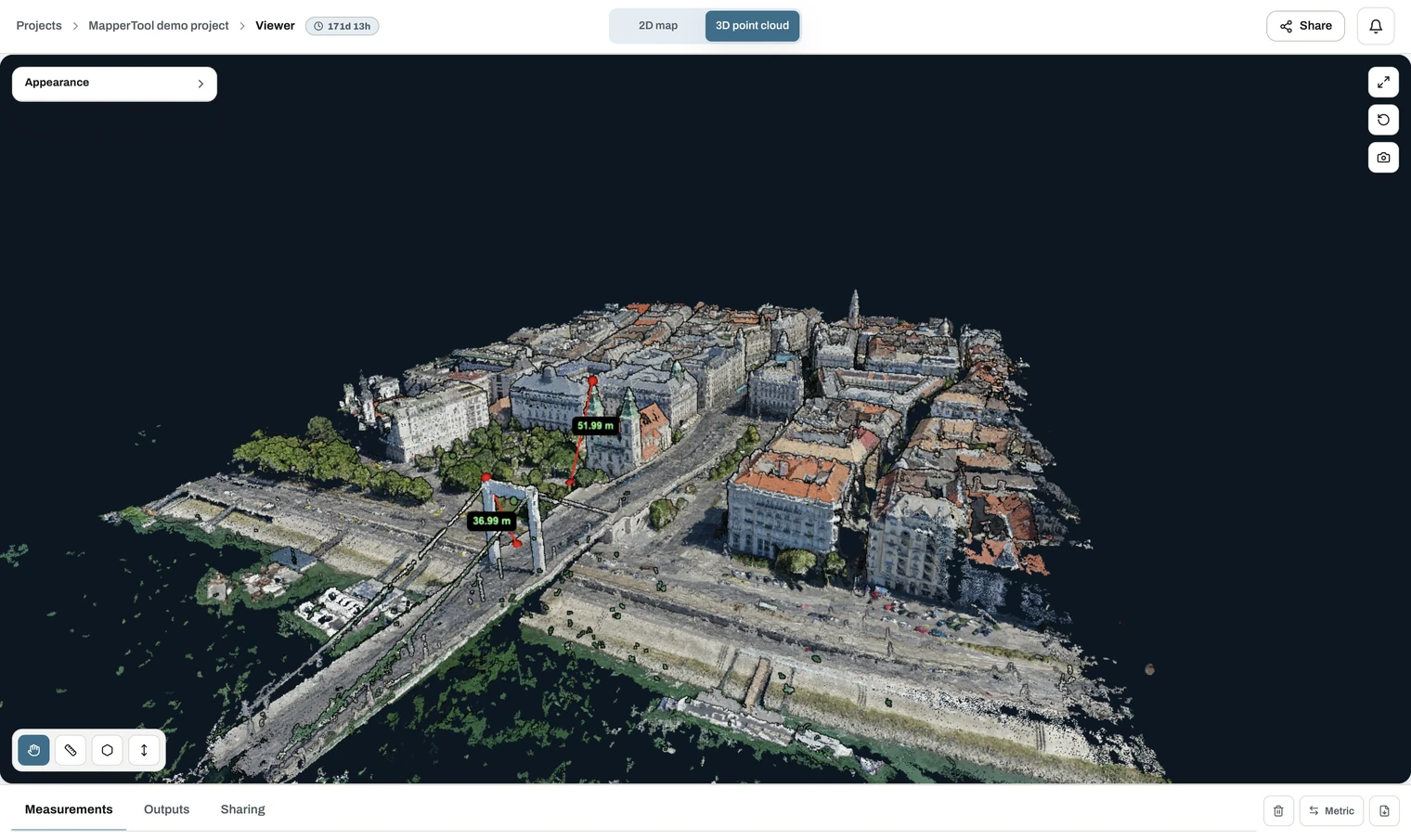
A point cloud is your site rebuilt in three dimensions. Millions of points, each with a real-world position and the colour it had in the photos. Together they form a measurable 3D copy of the scene.
This is what 3D mapping means in practice. You fly an ordinary camera drone, and the result is a point cloud map you can rotate, section and measure in the browser.
Download format: LAZ, the compressed form of the standard LAS point cloud
format. The viewer also reports the total point count,
for example 127.2 million points.
No extra sensor needed
The point cloud is reconstructed from the same photos as your other outputs, so an ordinary RGB camera is enough. Point density follows the quality level you select.
For a good 3D model, fly oblique or crosshatch passes as well as the nadir grid. Vertical surfaces are barely visible from straight above. See flight basics.
What it is used for
- True 3D inspection. Facades, slopes, undersides and structures a top-down map cannot show.
- As-built documentation. A dimensionally faithful record at a point in time.
- Volume and cross-section work in your own software.
- Client-facing 3D. Anyone with a share link can explore it in a browser.
It also opens directly in the 3D viewer, so you can check it before downloading.